Transforming your daily neighborhood walk into a ‘hyper-local’ history tour is the most effective way to foster community connection and provide a free, high-impact educational experience for your children without leaving your zip code.
- You don’t need to live in a world-famous historic city to find fascinating stories; every street has layers of social and economic history waiting to be decoded.
- Hyper-local exploration uses digital archives, old maps, and physical clues like “ghost signs” or architectural shifts to build a narrative of your immediate surroundings.
- For parents, these walks turn “boring” exercise into a gamified scavenger hunt that teaches kids critical thinking and a sense of belonging.
Have you ever looked at that weirdly shaped corner lot on your street and wondered why the house sits at a 45-degree angle? Or noticed a random patch of cobblestones peeking through a pothole in the asphalt? Most of us spend our 30s and 40s rushing between school runs, grocery stores, and home offices, treating our neighborhoods as mere backdrops to our busy lives. We save our “history” fix for expensive vacations to Europe or museum trips, completely ignoring the fact that the ground beneath our feet has its own complex, often surprising, biography.
The “Hyper-Local” history walk isn’t about visiting monuments. It’s about the “micro-history” of the mundane. It’s about realizing that your suburban cul-de-sac might have been an apple orchard eighty years ago, or that the local park was once a brickyard that built half the city. In an era where we feel increasingly disconnected from our physical locations due to the digital grind, reclaiming the story of your own street is a powerful way to ground yourself and your family.
The Philosophy of the “Micro-Adventure”
We often fall into the trap of thinking that history only happens in “important” places. We assume that if there isn’t a bronze plaque or a velvet rope, nothing of note occurred. This is a missed opportunity. Hyper-local history is the study of how ordinary people lived, how the landscape changed to meet human needs, and how the past continues to dictate the present layout of our lives.
For those of us balancing parenting and work, the hyper-local walk is the ultimate low-barrier activity. There is no packing the car, no entry fee, and no “tourist fatigue.” It’s an exercise in active observation. When you start looking for the “why” behind the “what,” your perspective shifts. You stop seeing a boring suburb and start seeing a living museum of urban planning, economic shifts, and social evolution.
This approach also counters the “anywhere-ness” of modern life. With the rise of global franchises and standardized architecture, many neighborhoods feel interchangeable. Digging into the specific history of your local area provides a “sense of place” that is vital for mental well-being and for giving children a stable identity within their community.
Phase 1: The Digital Detective Work
Before you lace up your sneakers, you need to do a little “couch archeology.” You don’t need a PhD; you just need access to a few specific types of records that are increasingly available online. This phase is actually great to do with older kids who are tech-savvy but maybe “bored” by the idea of a walk.
The Magic of Map Layering
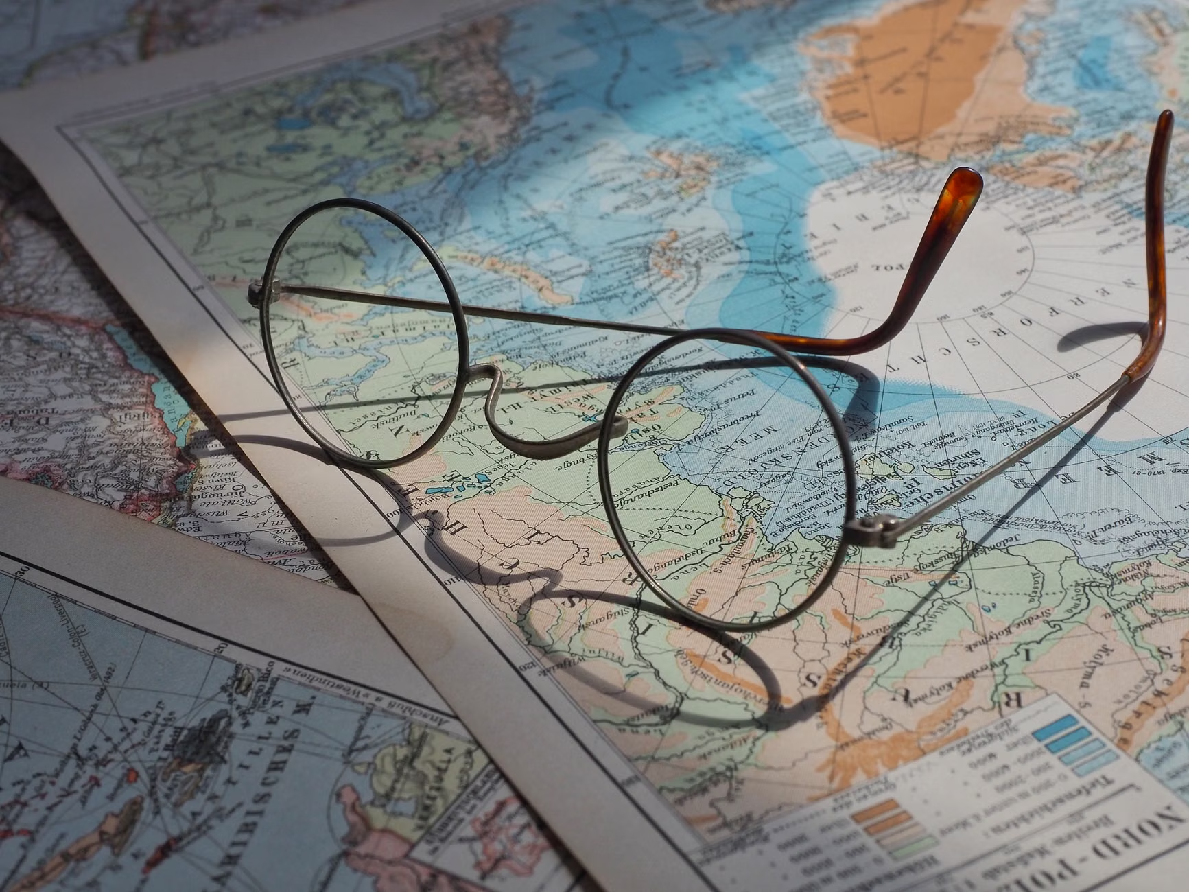
The single most useful tool for a local historian is the historical map. Many city libraries and national archives have digitized old plat maps or insurance maps (like the famous Sanborn maps in the US or Ordnance Survey maps in the UK). These maps were incredibly detailed because they were used to assess fire risk or property value.
When you compare a map from 1920 to a modern Google Map, look for the following:
| Feature | What it Signifies | Modern Clue |
|---|---|---|
| Vanished Waterways | Old streams or ponds filled in for development. | Unusually lush green belts or “dip” in the road. |
| Ghost Rail Lines | Old industrial spurs or tram tracks. | Long, narrow alleys or strangely straight walking paths. |
| Former Property Lines | Large estates broken into smaller lots. | A single very old tree in a row of young ones. |
| Industrial Sites | Former mills, tanneries, or smithies. | Unusually thick concrete pads or brick fragments in soil. |
Pro Tip: Use the “Historical Imagery” feature on Google Earth Pro (the desktop version). It allows you to slider back through satellite photos often as far as the 1940s or 50s. Seeing your neighborhood as a patchwork of farms or a construction site is a massive “aha!” moment.
Census Records and the “Human” Element
If you live in a house built before 1950, there is a high chance you can find out exactly who lived there. Census records (usually released after 70-80 years for privacy) list the names, ages, and occupations of every resident. Knowing that a “blacksmith” or a “telegraph operator” lived in your living room 100 years ago instantly turns a house into a home with a legacy.
Websites like Ancestry.com or local government archives often allow you to search by address. Sharing these names with your kids makes the history feel personal. It’s no longer “the past”; it’s “the story of the person who lived in your bedroom.”
Phase 2: Reading the “Text” of the Street
Now, it’s time to head outside. To do a hyper-local history walk, you have to stop looking at your phone and start looking at the details that usually fade into the background. We call this “reading the street.”
Architectural Transitions
Houses are the most obvious indicators of time. Even if you aren’t an expert in “Gothic Revival” or “Mid-Century Modern,” you can spot patterns. Look for the “join” where a neighborhood changes. Often, a sudden shift from brick to siding, or from narrow lots to wide ones, indicates a specific economic boom or a change in zoning laws.
Pay attention to the foundations. Modern houses often sit on concrete slabs. Older homes have raised foundations made of stone, brick, or heavy timber. Look for “coal chutes”—small iron doors near the ground—which tell you how the house was heated before the age of electricity and gas. These are tangible links to a time when daily chores were much more labor-intensive.
Ghost Signs and Faded Glory
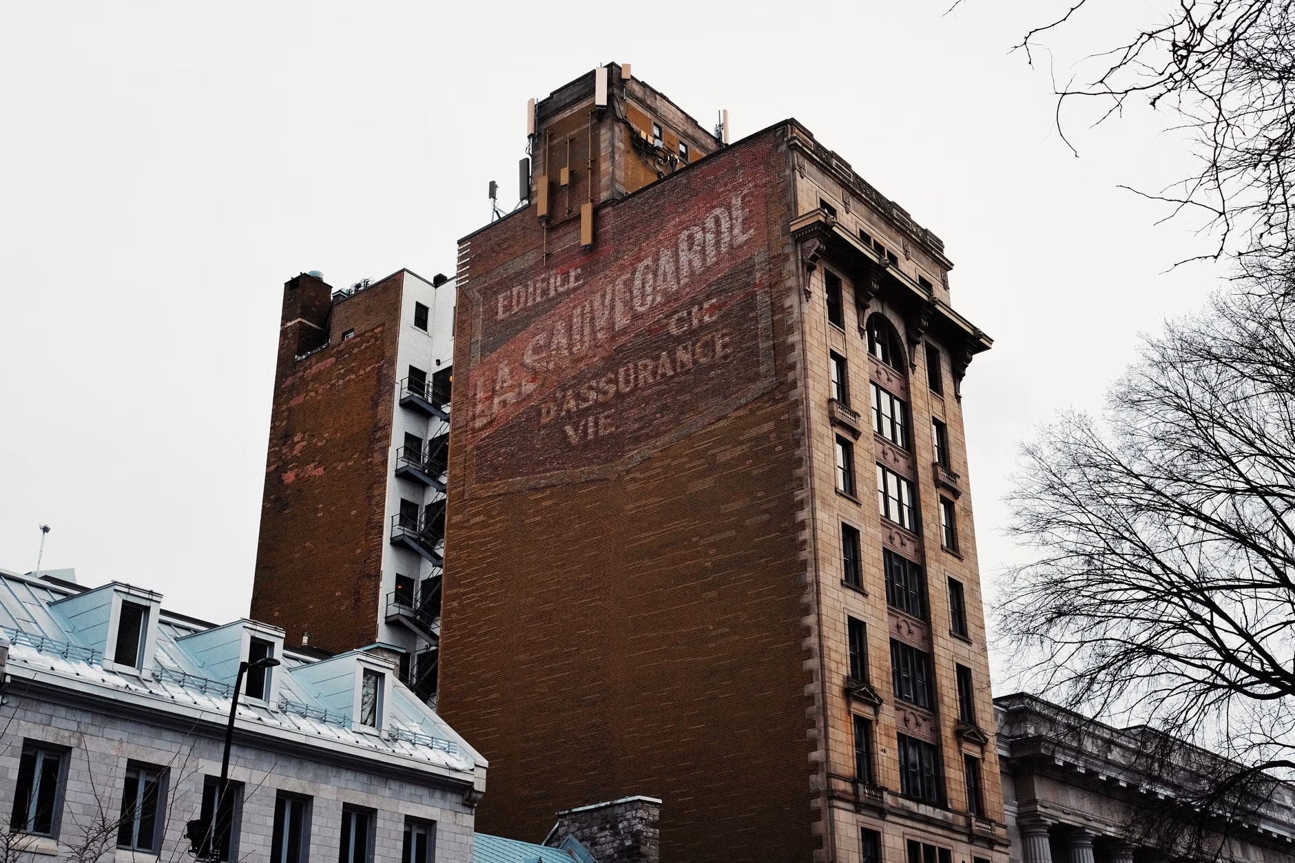
In older urban or semi-urban areas, look at the sides of brick buildings. “Ghost signs” are the faded remains of hand-painted advertisements from decades ago. They might advertise a brand of flour that no longer exists or a local grocery store that closed in the 1930s. These signs are “palimpsests”—layers of history where one era is written over another.
Finding a ghost sign is like finding a secret message. It tells you about the commercial life of the street. Was this a wealthy area? The signs might be for luxury soaps. Was it a working-class hub? Look for tobacco or heavy-duty workwear ads. These clues help you reconstruct the “vibe” of the neighborhood’s past.
The Ground Beneath Your Feet
Don’t forget to look down. Street furniture—manhole covers, curb stones, and utility markers—is often much older than the buildings surrounding it. Many cast-iron manhole covers are embossed with the name of the foundry that made them and the year they were installed. You might be walking over a piece of 1890s engineering every single day without realizing it.
Also, look for “mounting blocks” (large stones near the curb used for getting onto horses) or “boot scrapes” (iron blades built into the steps of old houses to scrape mud off shoes). These remind us that before the car, the streets were messy, animal-filled places.
Phase 3: Engaging the Kids (The “Gamification” Strategy)
Let’s be honest: if you tell a seven-year-old you’re going on a “history walk,” they might stage a protest. The key is to frame it as a detective mission or a scavenger hunt. You aren’t learning; you’re investigating.
The “Then and Now” Photography Challenge
Print out a few historical photos of your neighborhood (often found on local Facebook “Remembering [Town Name]” groups or library archives). Your child’s mission is to find the exact spot where the photographer stood 50 or 100 years ago. Once they find it, have them take a “now” photo from the same angle. This exercise in spatial awareness is incredibly engaging and helps them see the continuity of their world.
The Scavenger Hunt Checklist
Create a simple list of “clues” for them to find. This keeps them moving and looking at the environment rather than complaining about the walk. Here is a sample checklist you can adapt:
- A date stone: A year carved into the top of a building.
- A ghost sign: Faded paint on a brick wall.
- A hitching post: An iron ring or stone post used for horses.
- Old-fashioned glass: Windows that look “wavy” or have bubbles in them.
- A “mystery” object: Something made of iron or stone that doesn’t seem to have a modern use.
- A street name change: Look for old signs or markings on the ground.
The “Oral History” Interview
If you see a neighbor who has lived on the street for thirty or forty years, encourage your kids to ask one simple question: “What was the biggest change you saw on this street?” Long-term residents are the keepers of the “unwritten” history—the stories of the big storm of ’78, the old candy store that used to be a parking lot, or the “haunted” house that was torn down. This teaches children that history is something held by people, not just books.
Tools for the Modern Local Historian
While the physical walk is the star, a few digital tools can significantly enhance the experience. We are lucky to live in an age where massive amounts of data are at our fingertips.
- OldMapsOnline: An aggregator that lets you search for historical maps based on your current GPS location.
- What3Words: Useful for marking the exact location of a “discovery” like a hidden marker or a cool architectural detail to share with others.
- Geocaching: Many geocaches are placed near historical markers or interesting local sites. It adds a “treasure hunt” layer to the history walk.
- AI Tools (ChatGPT/Claude): You can describe a feature you found (e.g., “I found a brick with the stamp ‘BELDEN’ on it in Ohio”) and the AI can often give you the history of the company and the likely age of the artifact.
Why This Matters for Your Mental Health
In our 30s and 40s, we are often in the “crunch” years. We are managing careers, raising children, and worrying about the future. This can lead to a sense of “placelessness”—the feeling that we are just passing through our lives. Hyper-local history acts as an anchor.
When you know the history of your street, you feel a sense of stewardship. You aren’t just a renter or a homeowner; you are the current “caretaker” of a piece of land that has a long story. This perspective can reduce the stress of modern life by reminding us that we are part of a much larger, ongoing human narrative. We are just one chapter in the book of our neighborhood.
Furthermore, it’s a form of “Slow Travel.” You don’t need to fly to Tokyo or Paris to feel the wonder of discovery. There is wonder three blocks away, hidden in the pattern of a brick wall or the curve of an old road. It’s about cultivating “fresh eyes” for a familiar place.
A Checklist for Your First Walk
Ready to go? Use this table to prepare for your first official Hyper-Local History Walk.
| Step | Action Item | Tools Needed |
|---|---|---|
| 1. Pick a Loop | Choose a 1-2 mile loop starting from your front door. | Comfortable shoes. |
| 2. Pre-Search | Look up your street on a historical map (1900-1950). | Laptop/Tablet. |
| 3. Identify “Anomalies” | Note anything that looks “out of place” on the map. | Notebook or phone notes. |
| 4. The Walk | Walk slowly. Look up at second stories and down at the ground. | A curious mind. |
| 5. Document | Take photos of mystery objects or interesting textures. | Smartphone camera. |
| 6. Follow-up | Research the “mysteries” you found once you get home. | Google/AI/Local Library. |
Common Mistakes to Avoid
When starting out, it’s easy to get frustrated if you don’t find a “buried treasure” or a “secret tunnel.” Remember these points:
Don’t expect “Big” History: You likely won’t find where a King was crowned. You are looking for “Small” History—where the first grocery store was, or why the sidewalk suddenly narrows. Small history is just as valid.
Don’t trespass: This should go without saying, but stay on public sidewalks and paths. You can see a lot from the street without bothering your neighbors. If you do want to see something on private property, always ask permission; most people are actually thrilled to talk about the history of their old house.
Don’t rush: The goal isn’t cardio. The goal is observation. If you only walk half a block because you spent twenty minutes looking at an old retaining wall, that is a successful history walk.
Conclusion: The Legacy of the Local
By the end of your first few walks, your neighborhood will start to look different to you. That “boring” gray building is now “the old creamery.” That weird dip in the road is “the buried creek.” This knowledge transforms your environment from a commodity into a community. For your children, it builds a foundation of curiosity and a realization that the world is full of hidden layers waiting to be peeled back.
So, next Saturday morning, instead of heading to the mall or the crowded theme park, just step out your front door. Look at the curb. Look at the bricks. Ask “why?” You might be surprised at the answers your own street has been waiting to tell you.
For more resources on local history archives, visit:
– The Library of Congress Sanborn Map Collection
– Old Maps Online
– The National Archives (UK)
Frequently Asked Questions
Q: What if I live in a very new development (built in the last 10-20 years)?
A: Even new developments have history! Look at what was there before the houses. Was it a farm? A forest? A landfill? You can often find old stone walls or boundary trees that the developers left behind. Also, researching the “planning” history—why the neighborhood was designed this way—is a fascinating look into modern urban trends.
Q: How do I find historical photos of my specific street?
A: Start with your local library’s digital collection. Search for your street name or neighborhood name. Facebook groups like “I Grew Up In [City Name]” are also goldmines, as people often post personal family photos that show the background of the streets in the 50s, 60s, and 70s.
Q: Is there an app that tells me the history of buildings as I walk past?
A: There isn’t one perfect global app, but ‘Historypin’ and ‘WhatWasThere’ are great starting points where users upload historical photos to specific GPS coordinates. Some cities also have their own dedicated heritage apps, so it’s worth searching your app store for “[City Name] Heritage Walk.”
Keep exploring, stay curious, and remember that every step is a story.